The Ground Truth
When Public Land Maps No Longer Match the Land Itself
On a cool spring morning in Santa Barbara County, the trailhead looked exactly the way it did on the official U.S. Forest Service map — a tidy dashed line stretching inland through coastal sage scrub and oak. A promised path. But thirty minutes later, the “Trail — Open” line on the map collided with reality: a tangle of fallen limbs, washed-out ravines, and chaparral so dense it swallowed the corridor completely.
The map said a trail was here. The ground disagreed.
This gap between representation and reality — between a tidy GIS line and what hikers, hunters, bikers, and horseback riders actually encounter — is widening across the American public-land system. Wildfire, flood, beetle kill, landslides, and deferred maintenance are reshaping landscapes faster than agencies can map or repair them. The result is a quiet erosion of trust in one of the simplest public-land tools we have: the map.
A map is more than information. It is a contract — a guarantee that the public knows where it may go, how it may get there, and what rights are attached to that land. Under the MAPLand Act (Public Law 117-114), agencies like the U.S. Forest Service, Bureau of Land Management, and National Park Service are legally required to digitize and maintain access data. In theory, this creates a shared, accurate baseline for public access.
Across the country, that baseline is slipping.
Santa Barbara: A Local Case Study in a National Problem
To understand how quickly maps can fall out of sync, consider three trails in the fire-scarred front country above Santa Barbara — all appearing in federal datasets as open or historically existing.
A Trail That Exists on Paper, But Not on the Ground
What the USFS dataset shows as an active, publicly accessible trail is, in reality, little more than an indentation beneath decades of brush. Fire, erosion, and lack of maintenance have reclaimed the corridor. The map still insists it is open.
A Trail That Exists on the Ground, But Not on the Map
On a neighboring ridge, mountain bikers ride a lightly used singletrack that appeared on older USFS maps but has vanished from current datasets. The tread is still rideable, still used, and still passable — but removed digitally. Locals worry that when a trail disappears from maps, it becomes easier to de-prioritize or abandon entirely.
A Trail Erased Both Digitally and Physically
Some routes have been wiped out entirely. One such trail near the crest of the Santa Ynez Range was destroyed by fire and debris flows, then removed from USFS trail data. Both map and terrain now agree: the trail is gone.
Individually, these examples could be dismissed as ordinary data lag. Together, they reveal a national pattern: the terrain is changing faster than the maps.
A National Problem Hidden in Plain Sight
The U.S. Forest Service manages roughly 163,000 miles of trail, but decades of diminishing recreation budgets and shifting priorities have created an $8.6 billion deferred maintenance backlog. Even with supplemental funding from the Great American Outdoors Act, the Forest Service has publicly acknowledged that it cannot meaningfully reduce that backlog under current staffing and budget levels.
Meanwhile, climate impacts accelerate the breakdown:
- More than 5,000 miles of trail burn every year.
- Flooding and debris flows regularly wipe out trail infrastructure.
- Bark beetle outbreaks destabilize entire slopes.
- Megastorms reshape forests overnight.
Many official maps simply cannot keep pace.
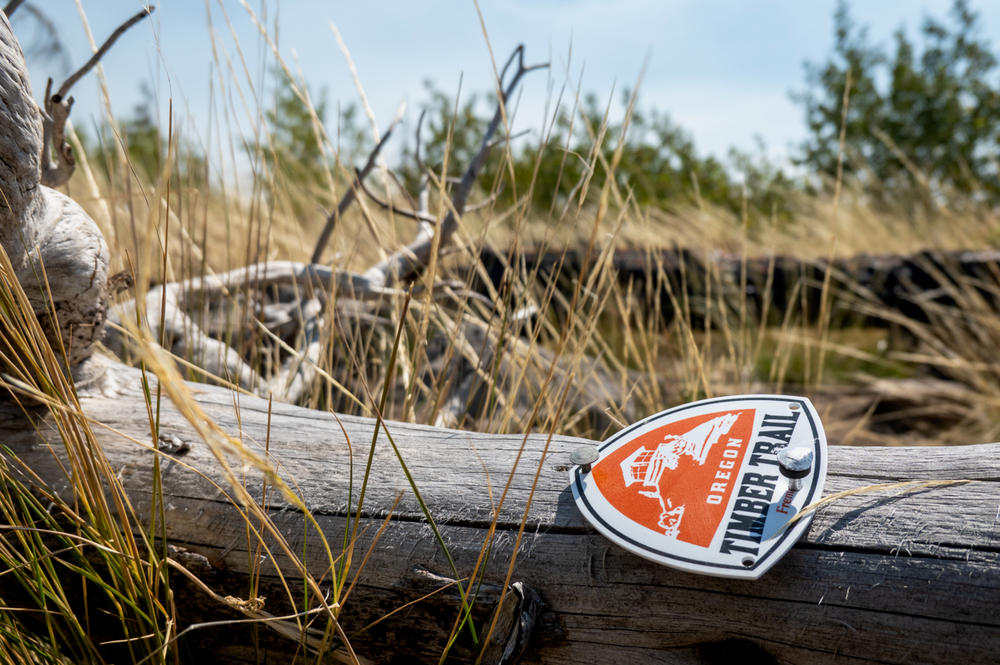
Oregon: The Beetle-Kill Maze
Central Oregon offers one of the starkest examples of ecological change outpacing federal mapping.
A regional bark-beetle impact map shows a patchwork of destruction across USFS lands, with trails threading through forests that are now fields of toppled trunks. What was once a smooth lodgepole corridor can become an obstacle course of stacked deadfall, some areas so choked that even volunteer crews cannot reach them.
Field photographs from the area show:
- Entire hillsides littered with beetle-killed timber
- Trail corridors completely hidden under multiple layers of downfall
- Burn scars mingling with beetle kill, compounding damage
On paper, many of these routes remain “open.” On the ground, they are impassable.
Colorado: Fire-Scarred Trails and Eroding Access
Colorado’s trail system sits at the intersection of serial wildfire, high-altitude erosion, and repeated burn-scar flooding.
Recent fire-impact maps reveal:
- Trails crossing areas burned multiple times over two decades
- Erosion-prone slopes where trail tread has collapsed
- Entire corridors where fire killed the canopy, then storms washed out the soil beneath
Field images show charred trail signs, scorched tread reduced to rubble, and volunteers attempting to resurrect segments that may take decades to stabilize.
Yet many of these trails still appear on federal datasets as if nothing has changed.
The East Coast: Hurricane Helene’s Overnight Rewrite
When Hurricane Helene hit the southern Appalachians, rainfall totals shattered records. Landslides swept down entire ravines. Trails that had existed for generations were buried in debris or washed out completely.
Maps of the event show hundreds of slide points scattered directly across USFS trail systems. In some areas, the hillside simply disappeared.
Yet in the weeks following the event, federal datasets still displayed many of those trails as open or unaffected — not out of negligence, but because updating these systems requires staffing and time that local ranger districts simply do not have.
Why the Map Gap Matters
While outdated maps may seem like a bureaucratic nuisance or a technical footnote, their consequences ripple far beyond navigation. Maps are the scaffolding that supports everything from emergency response to conservation planning to the economics of outdoor recreation. When they fail, they don’t just inconvenience hikers or mountain bikers—they distort how we understand and value public landscapes themselves. A trail that disappears digitally becomes easier to forget, deprioritize, or even defund. A corridor that looks open on a map but is impassable on the ground can change visitor behavior, shift pressure onto sensitive areas, or funnel people into unstable terrain. In a moment when the pace of ecological change is accelerating, the accuracy of our maps has become not just a question of convenience, but of stewardship, safety, and the long-term integrity of the public-land system.
Safety
Hikers and bikers increasingly rely on digital maps. When those maps show open trails that no longer exist, people get stranded or injured. Search and rescue teams across the country report increasing callouts tied to outdated information.
Conservation & Management
Accurate trail data is foundational to land-use planning. Outdated maps can:
- Misrepresent the scale of recreational impact
- Undermine ecological recovery efforts
- Lead to poor NEPA decision-making
- Conceal crisis-level infrastructure deficiencies
Funding
Inaccurate maps create a misleading picture of system health. Legislators see a dense, functional trail network on paper and assume no crisis exists — even as on-the-ground conditions collapse.
Public Trust
When the map no longer reflects reality, confidence in public-land institutions erodes.
What’s Breaking the System
The map gap isn’t the result of a single failure — it’s the cumulative effect of multiple slow-moving breakdowns inside a system stretched far beyond its design. Most are invisible to the average trail user. But together, they form the bottleneck that prevents our public-land maps from keeping pace with the landscapes they’re meant to represent.
Deferred Maintenance
Across the country, ranger districts are responsible for hundreds of miles of official trail yet staffed with only one or two full-time trail employees. In some forests — particularly in California, Oregon, Montana, and the Southern Appalachians — one person may be responsible for 300 miles or more. Even before a wildfire or flood hits, the math simply doesn’t work.
Maintenance backlogs accumulate in layers:
- A broken footbridge goes unrepaired.
- A washed-out switchback gets a temporary reroute.
- A season of blowdown leaves miles of corridor blocked.
- Volunteers step in, but their work often cannot legally substitute for agency responsibility.
Over time, these compounding failures become normalized conditions. In many places, trails listed as “open” are functionally open in name only — passable to a small number of determined locals, but not realistically safe or accessible to the general public.
Climate Disturbances
The climate disturbance cycle has shortened dramatically. Historically, a major fire might scar a landscape once in a generation. Now, a trail corridor in the Sierra, Los Padres, or Colorado Front Range might burn twice before the first post-fire assessment is completed. Flood-prone areas that once saw a 50-year storm every few decades now experience multiple catastrophic rain events within a single season.
In practice, this means:
- Fire crews move on long before trail crews ever arrive.
- BAER teams prioritize life and property, not recreation infrastructure.
- Hydrology shifts faster than tread can stabilize.
- Slope failures recur on the same trails year after year.
The ground keeps changing, but the maps rarely change with it.
Data Bottleneck
Even when local district staff know a trail has been destroyed, getting that information into national datasets is often a bureaucratic obstacle course. Updating a trail’s status requires time, technical GIS capacity, and a chain of approvals — all scarce resources.
It’s not uncommon for:
- A trail obliterated by a storm to remain listed as open for a year or more.
- Digitized “official” lines to be inherited from decades-old surveys.
- GIS specialists to work across multiple forests, unable to quickly update conditions after every event.
- Real field observations to lag far behind administrative datasets.
These bottlenecks aren’t malicious — they’re systemic.
Scale
America’s public-land system is sprawling by design. The U.S. Forest Service alone manages more trail miles than the National Park Service, BLM, and Fish & Wildlife Service combined. Yet the agency’s recreation staffing levels have declined for nearly 30 years.
The result is a mismatch of scale:
- Too many miles of trail
- Too few people to assess them
- Too little funding to maintain them
- Too little time to update maps
The terrain moves faster than the institutions that manage it.
A Crisis of Representation
Public lands are built on a social contract. The public agrees to steward these places; agencies agree to provide access and information. Maps are the shared language of that agreement.
When they fail, the contract frays.
Trails that exist only on paper create false expectations. Trails that exist only on the ground become vulnerable to erasure. Trails lost in both the physical and digital worlds fade from the collective memory of the public land system.
The Path Forward
Fixing the map gap does not require reinventing the American public-land system. What it requires is a modern understanding of how landscapes are changing — and the tools, funding, and partnerships to keep the public’s record of those landscapes accurate.
Renewed Investment
The numbers are stark: 158,000 miles of USFS trail, $8.6 billion in deferred maintenance, and annual recreation budgets that haven’t kept pace with inflation or climate impacts. Restoring credibility to the map begins with restoring capacity to the people who build and maintain the trails themselves.
This means:
- Stable, predictable recreation funding
- Dedicated trail crews rather than seasonal stopgaps
- Long-term capital improvement budgets, not emergency triage
- Incentives for retaining specialists in trail design, hydrology, and GIS
If the map is a promise, funding is its foundation.
Modernized Mapping Tools
The technology exists — in satellite imagery, lidar, drone surveys, and even machine learning — to update maps in near-real time. What’s missing is consistent agency integration.
A modernized approach could include:
- Automated detection of burn scars, debris flows, and blowdown
- Rapid “triage updates” that mark trails as temporarily closed until verified
- Clear differentiation between “open,” “passable with difficulty,” and “impassable”
- Direct syncing of field observations to federal GIS systems
- Public-facing layers that refresh weekly instead of annually
In other words, a map that behaves more like a weather forecast than a static brochure.
Community Ground-Truthing
Across the country, volunteer trail crews and local stewardship groups often know trail conditions weeks or months before federal datasets reflect them. This knowledge — currently siloed in local communities — represents an untapped resource.
A national system could formalize:
- Verified condition reports from certified volunteers
- Photo-based trail assessments submitted via mobile apps
- Local data pipelines that flow directly into USFS and USGS mapping tools
- Seasonal “condition audits” powered by nonprofits and user groups
When citizens help reveal the truth, agencies can focus on solving it.
Transparency
More than anything, the system needs sunlight. Users are not asking for perfection — they are asking for honesty.
Maps should clearly indicate:
- Trails in post-fire assessment
- Trails awaiting hydrology surveys
- Trails likely impassable due to deadfall
- Trails decommissioned but still visible on the ground
- Trails destroyed but still appearing in legacy datasets
A transparent map is not a sign of institutional weakness. It is a sign of integrity.
A Culture Shift
The future requires a shift in how we understand our public-land infrastructure. Trails are not static features. They are living systems — carved by climate, shaped by time, and maintained by human effort. Just as forests now burn differently than they did a generation ago, trails now behave differently, too.
A modern trail system must accept:
- That maintenance is ongoing, not occasional
- That access requires stewardship, not just entitlement
- That maps must evolve as quickly as the landscapes they represent
The path forward is not simply about fixing trails. It’s about rebuilding the relationship between public agencies and the people they serve.
Meanwhile, Back in Santa Barbara
The trail that existed on paper but not on the ground eventually petered out into a hillside that had slid years earlier, wiping away any trace of tread. On the return, the lesson was clear: the map was a record of the past, not a guide to the present.
A map is supposed to be a promise — that the trail exists, that the land is open, that the public still has a way through.
When the map no longer matches the land, that promise frays.
America’s trails deserve better than a system that can no longer keep up. And the public deserves maps that tell the truth about the ground beneath their feet.